 • successful trials of AVOID technology take place over Mount Etna
• analysis of two recent Icelandic volcanoes shows majority of flight cancellations would have been prevented with AVOID technology
• AVOID technology on schedule to be in commercial use by summer 2012
• Katla – next Icelandic volcano likely to erupt – potentially 10 times bigger than last two
Successful trials
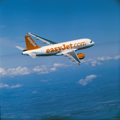
easyJet, the UK’s largest airline, and Nicarnica Aviation today revealed that successful testing has taken place of its unique ash radar technology. AVOID (Airborne Volcanic Object Imaging Detector) is a system that involves placing infared technology (developed by the US military) onto an aircraft to supply images to the pilot of ash in their flight path, enabling them to take avoiding action if necessary.
Testing has taken place during a two week period over the Sicilian volcano Mount Etna, the most active in Europe, as well as the island of Stromboli which is famous for its volcanic displays.
The AVOID system has been mounted onto a Flight Design CT microlight aircraft which has flown more than 30 hours in order to test the equipment. The flexibility and compactness of the microlight has allowed the project team to deploy quickly and measure plumes from different altitudes, distances and weather conditions.
The AVOID technology enables pilots to see an ash cloud ahead of the aircraft and at altitudes between 5,000ft and 50,000ft. At 20,000 ft ash clouds 100 km away can be detected. This will allow pilots to make small adjustments to the plane’s flight path to avoid any ash cloud. The concept is very similar to weather radars which are standard on commercial airliners today.
On the ground, information from aircraft with AVOID technology would be used to build an accurate image of the volcanic ash cloud using real time data. This would open up large areas of airspace that would otherwise be closed during a volcanic eruption, which would benefit passengers by minimising disruption.
Analysis of eruptions from 2010 and 2011
Using the same principles, Dr Fred Prata can also use infrared data downloaded from the European geostationary satellite system SEVIRI instrument and combine these data with a state-of-the-art atmospheric dispersion model to predict and report on where and in what concentration ash is present in the atmosphere.
The SEVIRI data and dispersion model analysis of the Eyjafjallajökull eruption in 2010 shows that areas of high concentration, in which aircraft cannot safely fly, comprised less than 2% of European airspace during the time that airspace was closed.
This analytic model was used in the response to the Grimsvotm eruption in 2011 and ensured that airspace was closed for far less time, thus avoiding unnecessary disruption to passengers.
On easyJet flights by 2012
easyJet and Airbus have agreed to work together on testing the AVOID technology. The two parties will meet soon to discuss Airbus flight test support for the AVOID project using an Airbus test aircraft.
The AVOID technology will also be put through a certification process with EASA (European Aviation Safety Agency). easyJet then intends to start installing the technology on its own aircraft as early as summer 2012 to minimise future disruption from ash.
Katla
Volcanologists predict that the next Icelandic eruption is likely to be from Katla which could be up to 10 times bigger than Eyjafjallajökull and Grimsvötn. Katla’s last major eruption was in 1918. The volcano usually erupts every 40 to 80 years, which means the next significant event is long overdue. It has recently started to show signs of an impending eruption. The effects of any eruption could be enormous so it is vital that technology is in place to enable Europe to continue flying.
Ian Davies, Head of Engineering for easyJet, said: “Safety is at the heart of the aviation industry which is why we saw the blanket shutdowns in reaction to volcanic ash over the past two years. In the absence of proven technology thousands of flights were grounded.
“This large scale grounding of flights should not happen again, thanks to both satellite and airborne technology which can be used to accurately predict not only the dispersal of ash from volcanic eruption but also crucially the levels of concentration.
“This ground-breaking technology is essential for the aviation industry and travelling public as it promises to minimise future disruption from volcanic activity – a very real and growing threat given that Katla is the next volcano predicted to erupt.
“The testing of the technology is an exciting next step in the journey to get AVOID onto easyJet aircraft which we hope to do by summer 2012.”
Dr Fred Prata Senior Scientist of Nicarnica Aviation and inventor of the system, commented: “Volcanic eruptions will continue to happen and air transport is vital to the global economy, so we need a practical solution to the problem of ash and aviation. The AVOID technology forms part of this solution, giving pilots tactical information that they can use to safely navigate ash hazards.
“These first airborne trials have demonstrated that AVOID can detect volcanic emissions reliably and we can now proceed confidently on to the next step in the program which will involve mounting the system on an Airbus commercial jet, flying at 30,000 ft.”
At the end of the process the AVOID system will be ready to go into mass production. easyJet believes that if 100 aircraft (20 of which would be easyJet’s) across Europe were to be fitted with AVOID equipment, this would provide comprehensive coverage of the continent enabling airlines to supply monitoring information to the authorities to support the new processes and procedures that were introduced after the eruption of Eyjafjallajökull in 2010. This vital information would enable all airlines to continue to fly safely in line with the CAA guidance of safe flying zones.*
Αρχική Airlines News easyJet and Nicarnica Aviation successfully trial AVOID ash detection technology


